
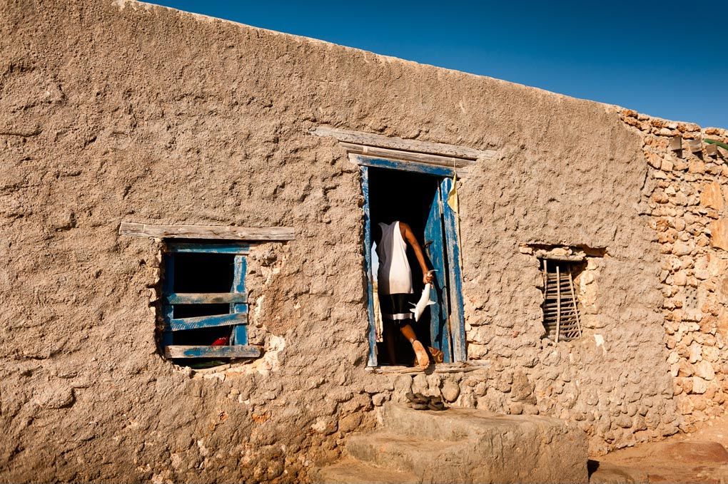
Socotra: An Island
by Claudius Schulze Islands — strange and magical, far away in dangerous waters — have for centuries driven Europeans to explore and to discover. Though by definition only “a piece of land surrounded by water” (Oxford Dictionary), the word describes more than just a landmass; the phrase island is inextricably linked with notions of how these places look, feel, and the myth tied around them: “They emphasize sensuality, escape, solitude, seduction, and self-sufficiency. ... Islands also can be lonely, inhospitable, forbidden, or mysterious.” (Resh & Resh 2009) German photographer Claudius Schulze traveled to the mysterious archipelago of Socotra, a lone island in the Indian Ocean, tectonic in origin and situated at 12°30’36” North and 53°55’12” East. Its nearest mainland is Somalia, 240km away. Socotra is sheltered by steep cliffs with a flat coastal plain in the north and a much smaller one along its southern shore. Behind the island’s capital town Hadibo, the cliffs rise to mountains, summiting in the over 1500m-high Hagghier. Steep-sided gorges and valleys cut through the central highlands. The only inland waters are small creeks gushing through the valleys. Only few are perennial and there is little arable land. The island was inhabited since the Stone Age but only discovered by Portuguese sailors in 1503. For centuries, the “Sheikhdom of Socotra Archipelago” was part of the “Mahra Sultanate of Qishn and Socotra” before being incorporated into modern Yemen less than 50 years ago.


بانوراما أخرى
Cosmic innovation: How Maurice Louca changed the rules to make <em>Elephantine</em>
It’s almost startling the ways that Louca, 36, has evolved as a musician over the years.

Saudi-backed Yemeni president cuts Cairo visit short after being summoned to Riyadh
Abd Rabbuh Mansur Hadi received an urgent request to return to the Saudi Arabian capital of Riyadh

Expelled Yemeni AUC student given provisional UNHCR protection pending asylum application
Does AUC have the right to ask a former student, expelled for violations, to leave the country?
Your support is the only way to ensure independent, progressive journalism survives.
You have a right to access accurate information, be stimulated by innovative and nuanced reporting, and be moved by compelling storytelling. Subscribe now to become part of the growing community of members who help us maintain our editorial independence.
Join us